NEWS RELEASE
MINISTRY OF NATURAL RESOURCES AND FORESTRY
******************************
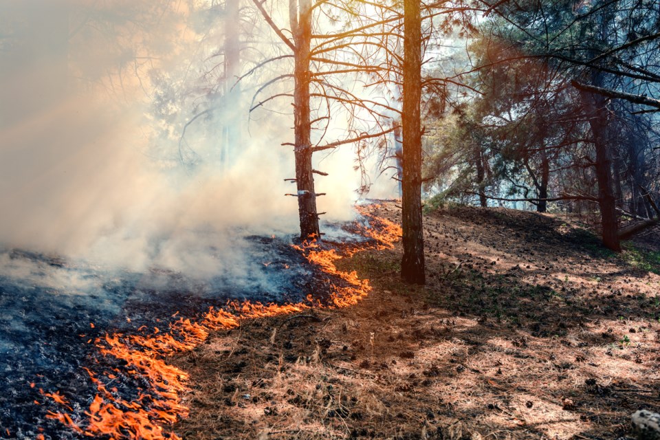
There are currently 27 active wildland fires in the Northeast Region. Of these, three are not under control, five are being held, seven fires are under control and 12 are being observed.
Six new fires were confirmed after Monday night’s update on July 3 in the region:
• Cochrane 26 is being observed and is 65 hectares. It is located approximately 22 kilometres east of Niskibi Lake in the Far North.
• Cochrane 27 is being observed and is 3 hectares. It is located approximately 17 kilometres east of Otter Lake in the Far North.
• Cochrane 28 is being observed and is 18 hectares. It is located approximately 10 kilometres east of Otter Lake in the Far North.
• Cochrane 29 is being observed and is 80 hectares. It is located approximately 15 kilometres east of Agusk Lake in the Far North.
• Cochrane 30 is being observed and is 1300 hectares. It is located approximately 10 kilometres east of Severn River Provincial Park in the Far North.
• Cochrane 31 is being observed and is 260 hectares . It is located approximately 24 kilometres north east Moshikopaw Lake in the Far North.
One new fire was confirmed Tuesday in the region:
• North Bay 7 is not under control and is 0.5 hectares. It is located approximately 3 kilometres north west of Buffalo Rock on the western shore of Lake Timiskaming. Four Twin Otter waterbombers and a lead birddog aircraft are conducting aerial fire suppression in the area this evening.
The fire hazard varies from high to extreme throughout most of the Northeast region. Areas southeast of Mattawa and generally south of Burk’s Falls are experiencing predominantly moderate to high fire hazard values. For a closer look at fire hazard conditions in your area, view our interactive map.
Fires of note:
• Cochrane 7 was confirmed on June 2. It is a 37,742 hectare wildland fire is located northeast of Lake Abitibi. Crews, intermediate helicopters, and heavy equipment committed to the fire. It is not under control.
• Cochrane 11 was confirmed on June 17. It’s estimated at 805 hectares and is located approximately 5 km west of the community of Fort Albany and south of Big Island. FireRanger crews are making good progress suppressing this fire. The fire is being held.
• Cochrane 25 is located approximately 21 kilometers southeast of Moose Factory and is 2.5 hectares in size.
• Chapleau 3 was confirmed on June 1. It is a 3,916 hectare wildland fire located 2 kilometres south of October Lake and 2.5 kilometres west of Vichaw Lake. It is being held.
• Chapleau 6 was confirmed on June 4. It is a 1,228 hectare wildland fire located 2.5 kilometres west of Morin Lake and 1 kilometre east of Bolkow Lake. It is being held.
Restricted Fire Zone in effect
A restricted fire zone remains in effect for the entire fire region of Ontario. Outdoor fires are banned.
In addition, we urge residents to use extreme care with any activities that could have the potential of sparking a fire, including parking or driving vehicles on dry grass or other forest floor susceptible to ignition from hot machinery (this can include cars, trucks, SUVs, ATVs, or other mechanical equipment).
Implementation Orders
Please note that effective as of 7a.m. Wednesday, July 5, 2023: Travel, use and access Restrictions will be revoked in the Northeast Region - MNRF Chapleau-Wawa District (CHA003 fire). These restrictions will no longer be in effect.
Travel, use, and access Restrictions in the Northeast Region – MNRF Hearst-Cochrane-Kapuskasing District (COC006 and COC007 fires):
• Under the Emergency Area Order (EAO 2023-03) effective June 5, 2023, the MNRF, Hearst-Cochrane-Kapuskasing District has put in an Implementation Order to protect public safety and to facilitate effective fire suppression. The following restrictions listed below and as outlined on the Implementation Order are now in effect until further notice:
⁃ All travel and use of the Translimit Road and Crossover Roads between the Translimit-Bingle Road junction at UTM Zone 17 E 548600 N 5436594 to the Ontario-Quebec border at UTM Zone 17 E 608042 N 5423187;
⁃ All use and occupation of Crown Land and roads within Marathon Township and Bowyer Township south of the former CN Rail Line;
⁃ All use and occupation of Crown Land and roads within the following townships: Moody, Galna, Knox, Kerrs, Steele, Berry, Sargeant, Bonis, Scapa, Hepburn, Abbotsford, Adair
For more information on these restrictions, see the Implementation Order Map. If you have any questions or require travel permits, please contact the Hearst-Cochrane-Kapuskasing District office at 705-272-7178 or by email [email protected]
******************************