WEATHER ALERT
ENVIRONMENT CANADA
**********************************
Winter storm warning in effect for:
• Elliot Lake - Ranger Lake
• Greater Sudbury and vicinity
• Blind River - Thessalon
• Espanola - Killarney
• Manitoulin Island
• Sault Ste. Marie - St. Joseph Island
Major winter storm continues into Saturday.
Hazards:
Total snowfall amounts of 25 to 40 cm by Saturday morning.
Snow squalls possible Saturday into Monday for the Sault Ste. Marie area.
Timing:
Continuing into Saturday.
Snow squalls potentially lasting until Monday.
Discussion:
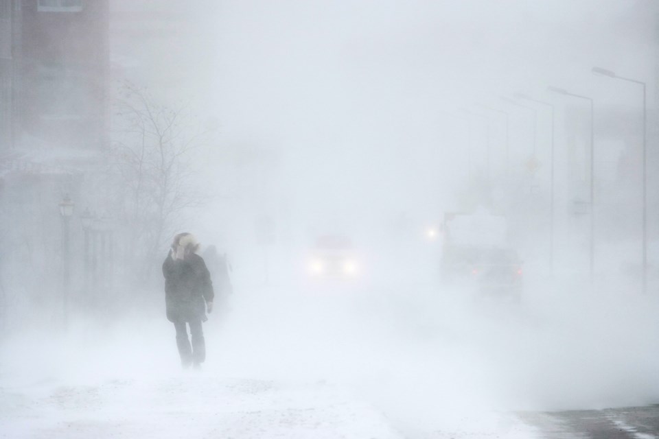
Snow heavy at times will continue today. The snow is forecast to taper off on Saturday. Strong northwesterly winds may then generate snow squalls for the Sault Ste. Marie area, bringing additional snowfall. Near zero visibility is possible at times.
Impacts:
Consider postponing non-essential travel until conditions improve. Surfaces such as highways, roads, walkways and parking lots may become difficult to navigate due to accumulating snow. Visibility may be suddenly reduced at times in heavy snow. Public Safety Canada encourages everyone to make an emergency plan and get an emergency kit with drinking water, food, medicine, a first-aid kit and a flashlight.
Please continue to monitor alerts and forecasts issued by Environment Canada. To report severe weather, send an email to [email protected] or tweet reports using #ONStorm.
**********************************