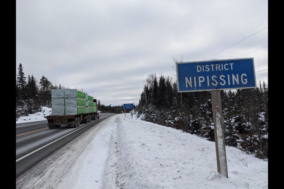
It seems like in the middle of nowhere you are driving across Northern Ontario and come across those large, blue highway signs acknowledging the Algoma District boundary and you look back in the rearview mirror and you see Sudbury District. Districts make us a distinctive part of the province.
You have to like maps. What do these imaginary lines mean anyway, they are on the Ontario road maps and show up in many government documents and websites? There are also other traditional lines that make maps open for interpretation beyond what a district means.
Districts can be enormous in size, ten in total define what we know as Northern Ontario legally; these include Manitoulin, Sudbury, Parry Sound, Nipissing, Temiskaming, Cochrane, Algoma, Thunder Bay, Rainy River and Kenora but not including the Sudbury Regional Municipality. When you receive an ‘Offence/Notice’ by the OPP you will notice in the particulars the ticket is within a “district.” What then is Northern Ontario?
Let’s get this out of the way; the Regional Municipality of Sudbury was a regional municipality that existed from 1973 to 2000, centred on the city of Sudbury.
It served as an upper tier of municipal government, aggregating municipal services of region-wide interest like the counties and regional municipalities of Southern Ontario, and was the only upper-tier municipal government ever created in Northern Ontario.
The regional municipality was dissolved with the creation of the amalgamated City of Greater Sudbury on January 1, 2001. It is the only census division in Northern Ontario which has the structure and function of a Southern Ontario census division.
Before you go on familiarize yourself with this excellent interactive map link then click on the larger version and go to the layers; start with the Indigenous Reserves or Settlements and Census Districts; there are many boundaries to consider.
In the summer of 2017 the Northern Policy Institute, North Superior Workforce Planning Board, and Local Employment Planning Council teamed up to create this map that shows all the different service boundaries in Northern Ontario; it’s not so confusing, is it?
Starting in 1858, districts were created in Northern Ontario for the delivery of judicial and provincial government services within the sparsely populated Northern Ontario. This included the surveying of townships, land registration and mining claims.
As populations grew new districts were created and boundaries changed. Census divisions are areas delineated for the purposes of statistical analysis and presentation and are considered a second-level census geographic unit. All of which, comes under the more contemporary Territorial Division Act, Division of Ontario into Geographic Areas and Delivery Agents - O. Reg. 136/98, which includes First Nations territories, within “geographic areas.”
After the creation of the province of Ontario in 1867, the first district to be established was Thunder Bay in 1871 which until then had formed part of Algoma District. The Ontario government was reluctant to establish new districts in the north, partly because the northern and western boundaries of Ontario were in dispute after Confederation.
Ontario's right to Northwestern Ontario was determined by the Judicial Committee of the Privy Council in 1884. By 1899 there were seven northern districts: Algoma, Manitoulin, Muskoka, Nipissing, Parry Sound, Rainy River, and Thunder Bay. Five more northern districts were created between 1907 and 1922: Cochrane, Kenora, Sudbury, Temiskaming and Patricia. The Patricia District was then merged into the Kenora District in 1927. One public school board, Keewatin Patricia retains part of this heritage definition.
Matt Carter, Media Relations, from the Ministry of Municipal Affairs and Housing acknowledged two important items. “The provincial government includes Parry Sound District as part of Northern Ontario but not Muskoka District and electoral ridings do not align with district boundaries.” This is the case for health units as well.
Unlike the counties and regional municipalities of Southern Ontario, which have a government and administrative structure and jurisdiction over specified government services, a district lacks that level of administration.
Districts are too sparsely populated to maintain a county government system, so many district-based services are provided directly by the provincial government. For example, districts have provincially maintained secondary highways instead of county roads. In a district, all services are provided either by the municipalities themselves, by local services boards in some communities within the unorganized areas, or directly by the provincial government.
If you zoom in to these district chunks you will see some zigzag lines these may follow surveyed township lines based on lines of longitude and latitude. Some boundaries follow railway lines.
Another boundary question is that small section of Highway 101 southwest of Timmins does not seem to fit. The highway leaves the Cochrane District enters the Timiskaming District and then quickly enters the Sudbury District. It would appear most likely that the district lines were created before the highway.
Indigenous communities and reservations mostly have natural boundaries like rivers and shorelines rather than the surveyed lines of townships of colonial times. See the layer First Nations Treaty Map.
Seventy-eight per cent of First Nation communities in Ontario are located in Northern Ontario. Here is an earlier Back Roads Bill Village Media story on traditional land boundaries, it explains why a major treaty boundary line oscillates across Northern Ontario.
Complementing all of this is a relatively new line, called the ‘Far North’ boundary that crisscrosses the province. Jolanta Kowalski from the Ministry of Natural Resources and Forestry Media Relations said this line came into effect on Jan. 31, 2011.
“The purpose, as set out in the act, is to provide for community-based land-use planning in the Far North that: Sets out a joint planning process between the First Nations and Ontario; it supports the environmental, social and economic objectives for land use planning for the peoples of Ontario. It Is done in a manner that is consistent with the recognition and affirmation of existing Aboriginal and treaty rights in section 35 of the Constitution Act, 1982, including the duty to consult,“ says the preamble to the act.
Ed Deibel, founder of The Northern Ontario Party in 1977 would have complicated all of these boundary lines. He campaigned for provincial status for the north for most of his political life. See the Village Media story.
It is a vast and magnificent land alright.
Northern Ontario has a land area of 806,000 km2 (310,000 mi2) and constitutes 88 per cent of the land area of Ontario.
There are 144 municipalities, 10 territorial districts, 106 First Nations, and more than 150 unincorporated communities, including 46 local services boards. With approximately 780,000 people it contains only about six per cent of the province's population.
There are no welcoming signs to Northern Ontario. Boundaries are complicated but the varying and divergent lines, rooted in history define what Northern Ontario is.